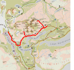
W Circuit self-guided, 4 Days / 3 Nights (September to April)
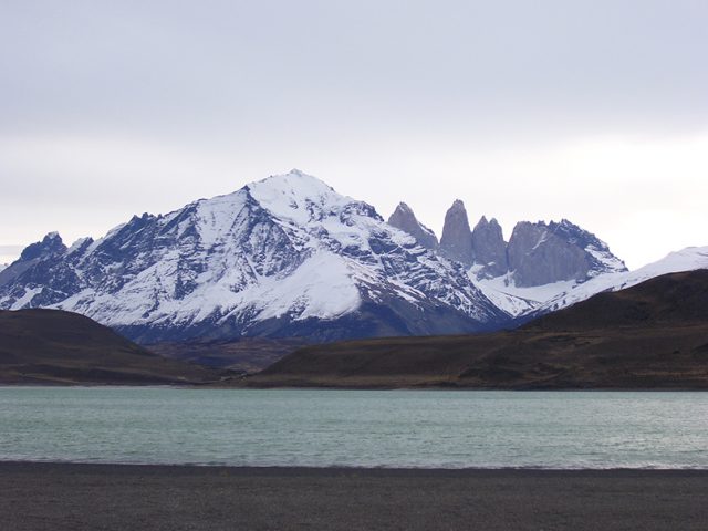
Day 1. Base of The Towers.
The regular bus departs at “Rodoviario” (bus station) at 7:00 am to start our trip to Torres del Paine National Park (150 km/94 miles, around 2 hours drive). You will going in direction Northwest on a beautiful route, across the typical Magellanic Estancias (ranches) of endless land and abundant sheep, within the immensity of the Patagonian pampas, molded by ancient glaciers. We are very likely to spot some indigenous fauna like guanacos (Patagonian lama), grey foxes, rheas (“ñandú”), flamingos and condors if we are lucky. As we approach the Park, the road will gradually introduce us to mountainous landscape. Once there, you must do the check in at the refugio or camping, to begin our hike to the Torres del Paine view point by a trail up the Ascencio River valley. Along the hike through dense beech forests (Nothofagus pumilio), we will stop to admire several waterfalls and hanging glaciers. After around three hours we will start to ascend a steep moraine towards the highest viewpoint for the Towers at 900 m.a.s.l. (2,950ft).
There, you’ll be rewarded with a close-up view of the massive granite towers (2.850m/9,350ft) and the milky green lake at their base. You will have lunch and relax in one of the most unforgettable settings in the world.
Then you will return along the same path to the Camping or Refugio Las Torres to sleep and have dinner.
| Hiking distance: | 7-8 hours Rt, 19 km / 11.8 miles |
| Elevation*: | 950 m/ (3,040 feet) |
| Physical Difficulty: | Medium-High |
Day 2. Los Cuernos (The Horns).
After breakfast you have to start the trek to Refugio Cuernos. We will hike on undulating terrain surrounding Mount Almirante Nieto (2.860m/8,790ft), along the north shore of Lake Nordenskjöld, one of the largest lakes in the Park.
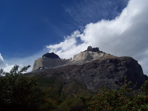
Then you will be surprised by the impressive sight of the Cuernos del Paine (horn-like granite peaks), composed by granite and sedimentary rock, with some features that make them unique in the world. In the shadow of these towering giant horns stands the Camping Cuernos, where we will have dinner and spend the night.
| Hiking distance: | 5 hours, 11,5 km / 7.2 miles |
| Elevation*: | 150 m/ (480 feet) |
| Physical Difficulty: | Medium. |
Day 3. French Valley.
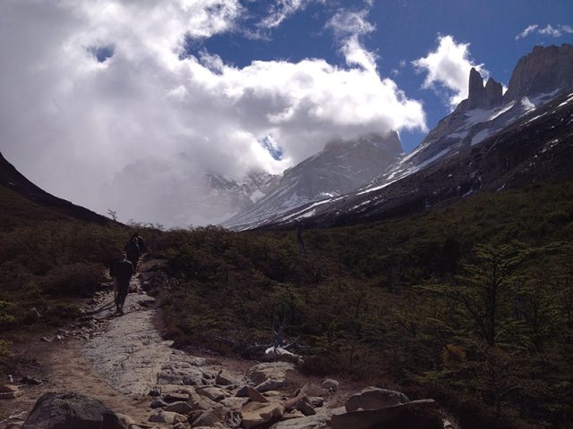
Early in the morning you will head west in direction to the Valle del Francés (Frenchman’s Valley), one of the most beautiful places in the Park. You will surround the Cuernos walking by Lake Nordenskjöld’s shore, and then you will climb to our first amazing lookout to admire an ample view of the whole valley, the lake, and the enormous Mount Paine Grande (3.050m/10,000ft), the highest in the Park.
You will arrive at Camp Italiano, from which you will start our one-hour ascent up the valley above the Glacier “del Francés” (Frenchman’s valley). On our way up the moraine, the lenga and coigüe (N. pumilio and N. betuloides) forest around us is shaped by the wind to resemble a Japanese garden. Once at the lookout the views are amazing with a range of 360 degrees: panoramic views of the lakes below, surrounding granite peaks, and the hanging glaciers of Paine Grande in front of you.
There you will enjoy the lunch watching avalanches cascade and condors soar. You might have the chance to keep going up to the furthest viewpoint past Camp Británico, to arrive into the middle of a breathtaking amphitheatre of granite spires.
After a brief stop you will return along the same path to Camp Italiano and then continue walking west along the south face of Mount Paine Grande, passing by deep blue Lake Skottsberg. Once you see Lake Pehoé, of intense turquoise waters, you will be really close to our final stop, the Lodge Paine Grande, where you will have dinner and spend the night.
| Hiking distance:(partly optional) | 8-10 hours, 26 km / 16 miles |
| Elevation*: | 500 m/ (1,600 feet) |
| Physical Difficulty: | Medium-High. |
Day 4. Glacier Grey.
Early morning after breakfast we will start hiking north toward Glacier Grey, taking a beautiful trail along the western face on Mount Paine Grande.
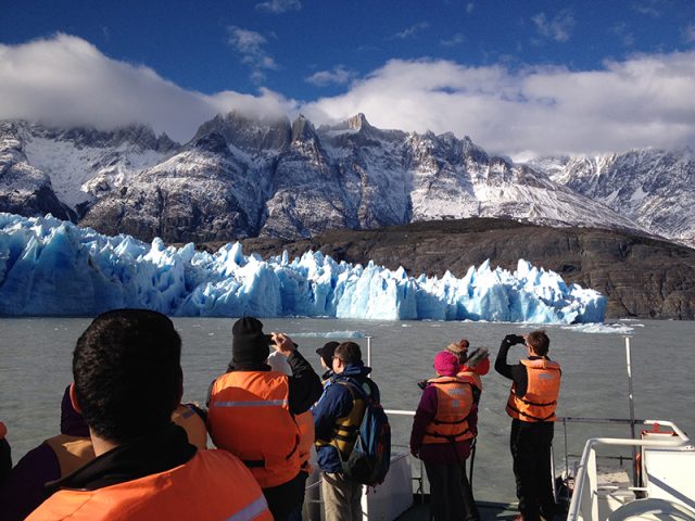
After an hour we will start to see the countless snowy peaks of the Andes which hold the Southern Patagonian Ice Field and the many glaciers that flow down from it. Then the trail will lead us to open terrain that overlooks Lake Grey, allowing us views of its greenish grey waters in contrast with deep blue, floating icebergs.
In another hour we will arrive at “the half-way viewpoint”, which offers a breathtaking panorama of the glacier and the snow-capped mountains around us.
Then we continue going in and out of the forest, until reaching our last stop in front of the eastern arm of the glacier, where we will have lunch and, if we are lucky, observe blocks of ice calving off the front face of the glacier.
The returne is by the same trail to Paine Grande lodge where you can take the last Catamaran at 18:30 hours to go to the other side of the lake where our private vehicle will be waiting to take you back to Puerto Natales (2 hrs). We will drop you off at your accommodation and wish you a warm goodbye.
| Hiking distance: | 4 hours, 11,5 km / 7.2 miles |
| Elevation*: | 300 m/ (960 feet) |
| Physical Difficulty: | Medium. |
*References for elevation: m/ (up and down the elevation mentioned)
Rates:
| Nights in Camping | Nights in Refugio | |
| Price per person USD$ | USD$ 1.200 | USD$ 1.490 |
Includes:
- Regular Bus (from Puerto Natales to the Park, round trip)
- Park entrance fee
- Three nights in Refugio or camping with all equipment
- All meals (breakfast, lunch and dinner)
- Catamaran Pehoe Lake (OW)
Not included:
- Guide
- Extra nights
- Extra food ans drinks (alcoholic and non-alcoholic)
- Insurance of any kind
- Medical expenses
- Tips
Travel Map:
